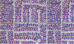
Researchers at the Oak Ridge National Laboratory in Tennessee developed a deep learning-based system that can map every building in the contiguous United States from satellite imagery. The system, which is the first to map the country and the spatial extent between buildings, has the potential to help emergency planning before and after a disaster strikes. ��The generated model output covering��
]]>